GTC 2026 just wrapped and wow, what a week. I’ve never been to a large tech conference like this and I get why they call it the “Woodstock of AI.” Over 30k people gathered in downtown San Jose with lots of great conversation, tech demos, excitement and rubbing elbows with big names in tech. More photos around my experience here.
But before the conference, as an NVIDIA staff member and host, I wanted to be able to genuinely help everyone I met there. Whether that’s pointing someone to a good lunch spot, giving directions to the nearest hotel, or just knowing the lay of the land well enough to be useful. The problem is I don’t live in San Jose, and staring at a flat map only gets you so far.
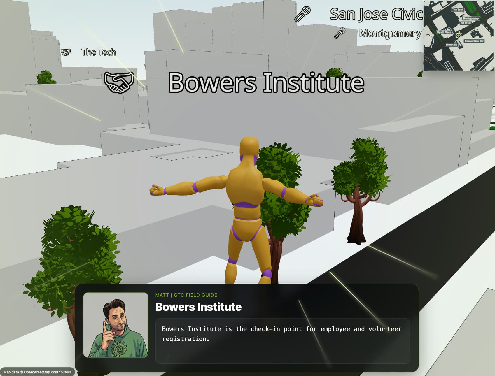
So I built a small 3D web game that lets you explore a roughly true-to-scale model of the downtown San Jose area. Walk around the city, find landmarks and restaurants, and get a real feel for the layout. Instead of squinting at a 2D map the night before, you can actually wander the streets and get a sense of how everything is positioned relative to the convention center.
The experience runs in the browser with no install required. On desktop you get pointer-lock WASD movement, on mobile there’s a joystick, and it also supports WebXR for VR headsets but I haven’t tested it much. Here is a live demo you can try out: GTC 2026 Web Interactive Map Game

The city geometry was pulled from OpenStreetMap data using the blosm Blender add-on, then exported as a GLB for the web.
The map is built from real OpenStreetMap data using the awesome Blender Blosm add-on I just recently discovered.
I added points of interest, street labels, and a set of discoverable restaurants and cafes that reveal themselves when you get close. There’s also a minimap in the corner.

The minimap follows the player with a top-down ortho camera and surfaces nearby labels as you move around.
Why This Could Be Useful Beyond Just Me
While I built this for my own prep, I keep thinking about how something like this could be genuinely useful at a larger scale for events.
Event marketing. Imagine dropping a link like this into a conference email or landing page. Instead of a static venue map, attendees get a walkable 3D preview of the area. That’s a way more memorable touchpoint than a PDF floor plan. It could even be gamified with collectibles or challenges to build hype before the event starts.
Staff prep and training. If you’re coordinating volunteers or event staff who have never been to the venue before, giving them a spatial walkthrough ahead of time could cut down on confusion day-of. Where’s the registration desk relative to the main hall? Where are the closest lunch spots to send attendees? Staff could already be experienced in navigating the area.
Know before you go. For attendees, especially folks traveling from out of town, having a sense of the surrounding area is really helpful. Where to grab coffee before the keynote, which hotels are walkable, what the vibe of the neighborhood is like. Looping in other players, even in small groups ahead of time could be a really fun way to build relationships ahead of the event.
I think there’s something here and we are in an era where these kinds of web games could be built in short time frames. The toolchain (OpenStreetMap + Blender + React Three Fiber) is pretty accessible and most of the heavy lifting is in the data, not the code.
It’s a small project but it scratched an itch I’ve had for a while, using the spatial web for something genuinely practical.
It actually worked well for me in helping me learn the lay of the land. I was confident navigating the area and was able to immediately find my way day one and help others without consulting a map in many cases. If I had more event content to add, it would have been even more powerful. Hope to see someone run with this idea someday and build a good web game as a pre-conference training/fun prep experience.